File:Computational region two rasters.png
Size of this preview: 781 × 600 pixels. Other resolution: 798 × 613 pixels.
Original file (798 × 613 pixels, file size: 250 KB, MIME type: image/png)
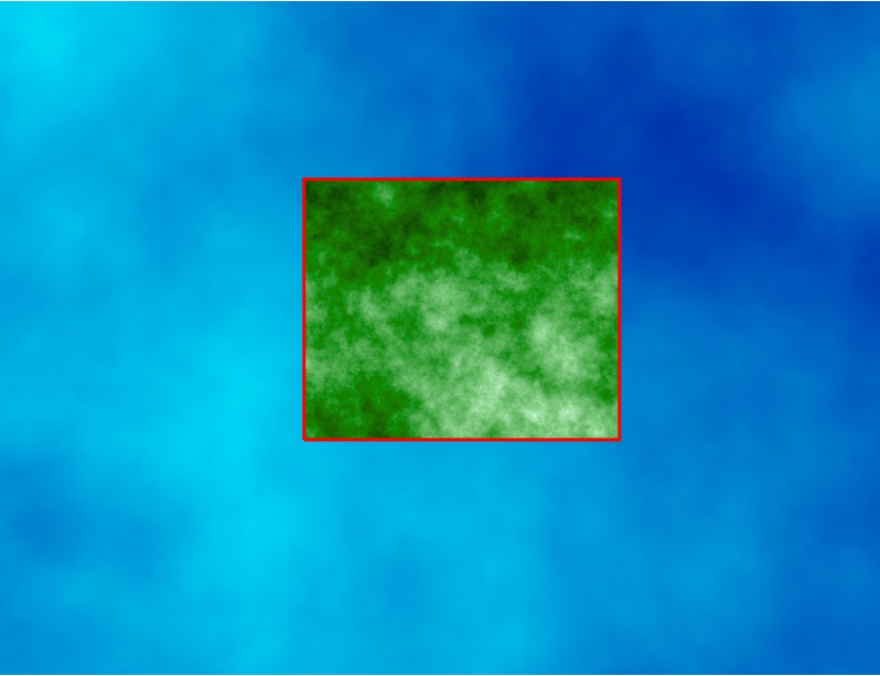
Computational region concept showing one large raster (blue) and one other raster with smaller extent (green) which matches the current computational region (red).
# larger region
g.region raster=elevation
# larger raster
r.surf.fractal output=fractals_big dimension=2.05
# smaller region
g.region n=221910 s=219300 w=639150 e=642310 res=1
# smaller raster
r.surf.fractal output=fractals_small dimension=2.5
# color tables
r.colors map=fractals_big color=water
r.colors map=fractals_small color=grass
# display rasters
d.rast fractals_big
d.rast fractals_small
# smaller region as vector
v.in.region output=region type=line
# display region
d.vect map=region color=red width=3
File history
Click on a date/time to view the file as it appeared at that time.
| Date/Time | Thumbnail | Dimensions | User | Comment | |
|---|---|---|---|---|---|
| current | 13:40, 24 March 2017 | | 798 × 613 (250 KB) | ⚠️Wenzeslaus (talk | contribs) | Computational region concept showing one large raster (blue) and one other raster with smaller extent (green) which matches the current computational region (red). # larger region g.region raster=elevation # larger raster r.surf.fractal output=fra... |
You cannot overwrite this file.
File usage
The following 7 pages use this file:
- Analytical data visualizations at ICC 2017
- Analytical data visualizations at ICC 2017/es
- From GRASS GIS novice to power user (workshop at FOSS4G Boston 2017)
- Processing lidar and UAV point clouds in GRASS GIS (workshop at FOSS4G Boston 2017)
- Processing lidar and UAV point clouds in GRASS GIS (workshop at FOSS4G Boston 2017)/es
- Unleash the power of GRASS GIS at US-IALE 2017
- Unleash the power of GRASS GIS at US-IALE 2017/es