GRASS GIS at US-IALE 2017 Annual Meeting

The US-IALE 2017 Annual Meeting, People, Places, Patterns: Linking Landscape Heterogeneity and Socio-Environmental Systems, April 9 - 13, Baltimore, Maryland, http://baltimore2017.usiale.org
Workshops
- Conference program link: http://baltimore2017.usiale.org/workshops
Unleash the Power of GRASS GIS
by Brian Pickard from NCSU (US-IALE Student Representative), Vaclav Petras from NCSU (presenter), Anna Petrasova from NCSU (presenter), and Rose Graves from UW-Madision (US-IALE Student Representative)
- Invited student organized workshop
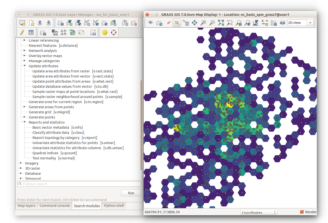
- Abstract: In this workshop we will introduce GRASS GIS 7, a free and open source scientific platform for geoprocessing. The workshop will provide a step by step tutorial to guide beginners from basic raster and vector analysis to more complex topics such as landscape structure analysis, lidar data processing, and spatio-temporal data handling and visualization. Participants will also learn how to use GRASS GIS with Python to optimize their workflows, and how to leverage the integration of R with GRASS GIS for statistical analysis.
- Prerequisites: No prior knowledge of GRASS GIS, Python or R is required.
- Intended audience: students
- Workshop materials: Unleash the power of GRASS GIS at US-IALE 2017
Emerging technologies in participatory design
by Anna Petrasova, Payam Tabrizian, Brendan Harmon, Vaclav Petras, Helena Mitasova, and Ross Meentemeyer from North Carolina State University
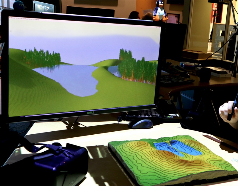
- Abstract: We will run an interactive workshop presenting innovative technologies bridging landscape ecology and landscape architecture. In this workshop participants will learn, use, and apply tangible geospatial modeling and immersive virtual environments to understand and explore ecological issues. We will introduce Tangible Landscape, a technology that links an interactive physical model with GRASS GIS and Blender through a real-time cycle of interaction, 3D scanning, geospatial computation, and 3D rendering. Through hands-on interaction, participants will solve 1) a simple planting design problem exploring trade-offs between environmental processes (such water flow and erosion) and aesthetics, and 2) a more complex problem dealing with habitat connectivity and human experience. As part of the workshop, we will introduce participants to GRASS GIS, an open source scientific platform for geoprocessing, and Blender, an open-source 3D modeling, simulation, and game-engine platform. With Blender you can intuitively interact with GIS data and generate lifelike renderings of natural and urban landscapes for immersive virtual environments. Participants will learn how to prepare data, build physical models and develop workflows so that they can use emerging, open source technologies for stakeholder engagement and participatory design.
- Intended audience: professionals, students, ecosystem modelers, landscape architects, GIS analysts
- Software used or presented: Tangible Landscape, GRASS GIS, Blender
- Canceled by organizers, replaced by exhibit during a poster session (same content, but unstructured)
Presentations
Not seeing the forest for the trees: viewscape modeling with LiDAR
by Jelena Vukomanovic (presenter), John B. Vogler, Kunwar K. Singh, and Anna Petrasova from North Carolina State University
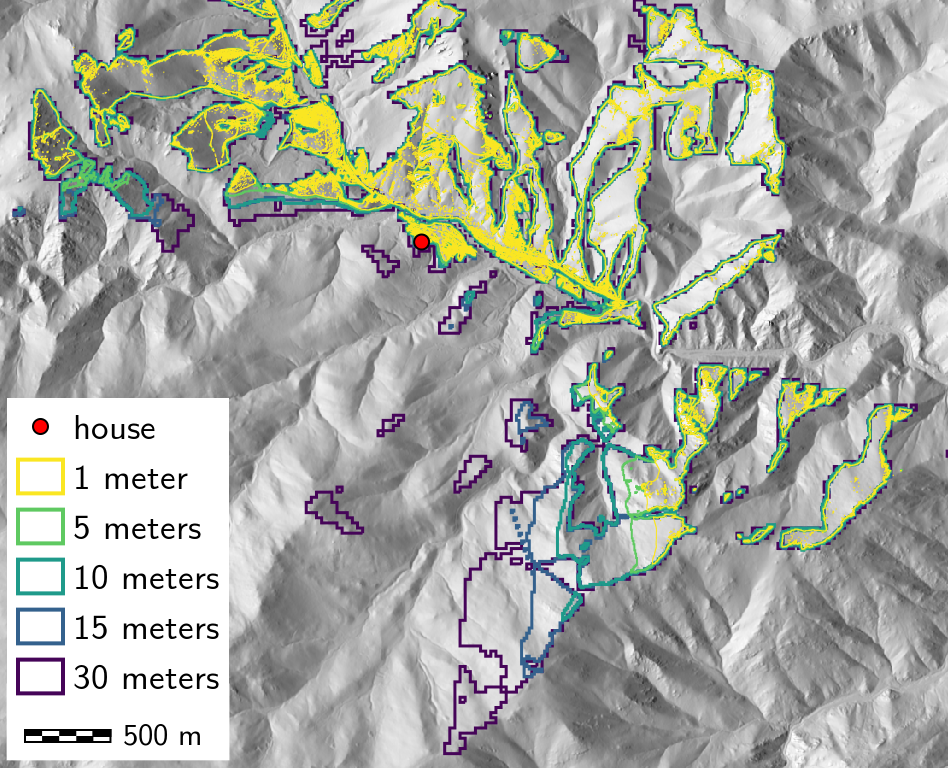
- Abstract: Viewscapes are composed of the areas of land, water, and other elements that can be seen from a given point. These features can be biophysical, such as vegetation or water features, or social, such as the visibility of neighbors or cultural and religious sites. To date, most viewshed analyses have used bare-earth layers, which exclude vegetation and human infrastructure, as inputs; these elements are crucial for understanding both visibility and landscape preferences. _x000D_In this study, we examined the viewscapes of 1000 real homes in Boulder County, Colorado using both bare-earth (BE) DEM and top-of-canopy (ToC) DSM input layers, at five different resolutions (1, 5, 10, 15, and 30 m). We overlaid the BE and ToC viewsheds, at all resolutions, with preference metrics (privacy (distance and number of visible neighbors), terrain complexity, greenness, visual scale, vegetation type/diversity) to create viewscapes. In this forested, mountainous region, we found that BE models overestimated the size of viewsheds approximately 400% (306-456%) compared to ToC models. This “4x” rule was consistent across resolutions and for both BE and DSM, coarser resolutions resulted in increasingly over-estimated viewsheds. A key interest in the use of viewscapes is that this approach can help inform our understanding of preference and these different modeling approaches result in different preference metric results. ToC representations find greater privacy (fewer visible neighbors and longer distance to closest visible neighbor), a more rugged, complex terrain, and higher (normalized) vegetation type density. By testing these preference metrics directly, we gain better understanding of what these approaches mean for real applications.
- Conference program link: http://baltimore2017.usiale.org/presentation-details/19656
Related modules and functionality: r.viewshed, r.univar, r.to.vect, r.mapcalc, PyGRASS, vector attributes in PostgreSQL, ...
3D rasters are powerful and you already know how to use them
by Vaclav Petras (presenter), Anna Petrasova, and Helena Mitasova from North Carolina State University
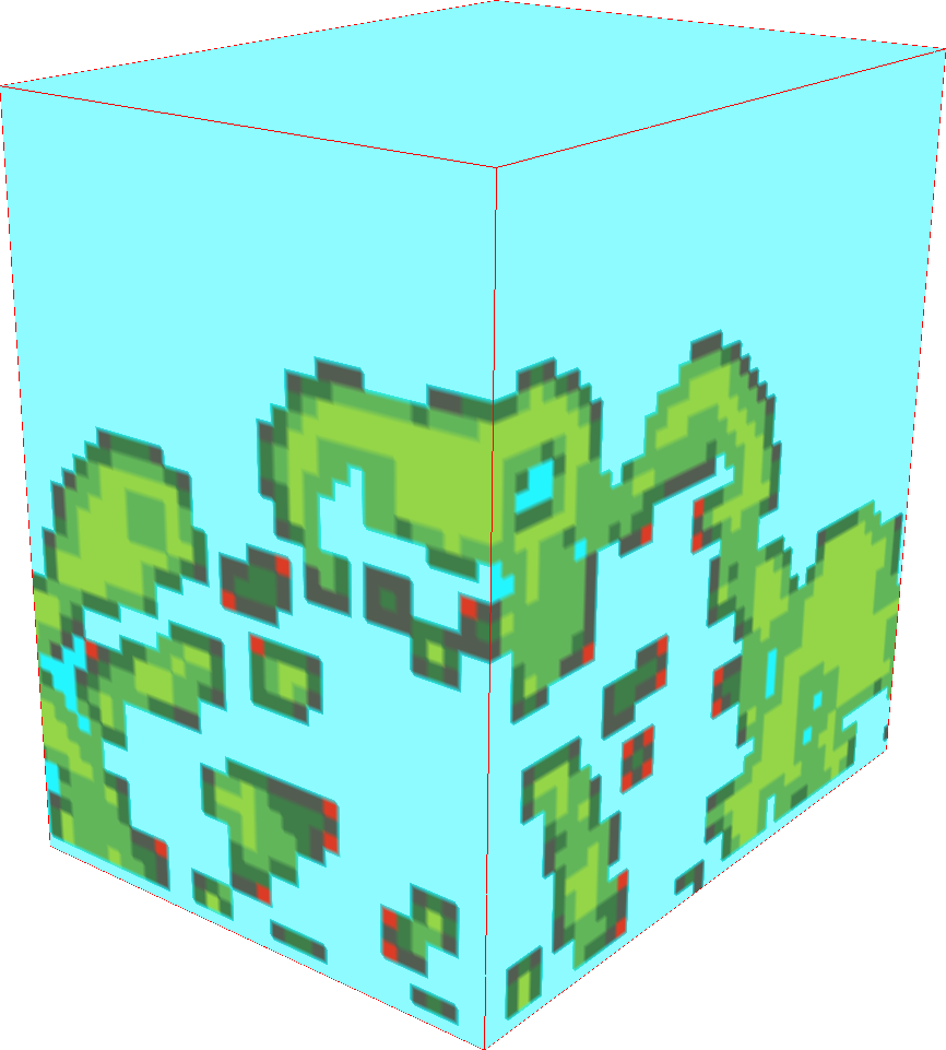
- Abstract: 3D rasters (aka voxel models) have been used to represent and process hyperspectral data, describe forest and habitat properties, analyze measured spatio-temporal data, or explore simulation scenario space. 2D and 2.5D does not explicitly represent and model 3D relationships in fully 3D systems such as forest ecosystems. 3D rasters on the other hand, preserve the original relationships in the 3D data. The relationships in the third dimension may be different from the first two dimensions which distinguishes 3D rasters from 2D rasters. Other than that, 3D rasters are very similar to the commonly used 2D rasters and there are tools available to process them including Python, R, or Octave. We will demonstrate 3D raster algebra in GRASS GIS as an example of 3D raster processing fully integrated into a general-purpose GIS and remote sensing tool. Using examples of terrain evolution data, 3D vegetation structure derived from lidar point clouds, and spatio-temporal data representing behavioral patterns of people in urban environments, we will look not only at the processing but also at the visualization of 3D rasters. Finally, we will show how to use Python and Bash scripting or visual programming to make the best use of 3D rasters.
- Conference program link: http://baltimore2017.usiale.org/presentation-details/19524
Related modules and functionality: 3D rasters, r3.mapcalc, 3D view, ...
- Slides: https://wenzeslaus.github.io/raster3d/us-iale2017.html (HTML)
How to make your research reproducible
by Vaclav Petras from North Carolina State University
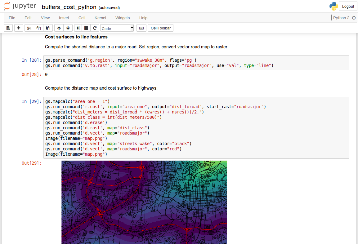
- Abstract: As scientists we heavily rely on computers in general and software in particular to carry out significant part of the analysis. However, as a scientific community we have been largely unsuccessful in sharing our research methods and results in a reproducible way. Since current scientific publishing requires more than writing a paper, we need to use new ways of sharing our research and fortunately for us, there are many tools to do so. For example, Jupyter and R Markdown let us track the reasoning behind our experiments and analyses. We can use Python and other languages to access powerful software features in an automated way instead of hoping we entered the same values as last time when rerunning the analysis with a new climate dataset. Revision control tools such as Git help us to collaborate and keep track of our constantly evolving methods and R scripts. Finally Docker and Vagrant let us wrap entire workflow into one runtime environment so that our species distribution model can be used without our personal laptop. This talk will discuss several tools for reproducible research and show practical examples which will make your life and lives of your colleagues easier. A terrain modeling paper will serve as an example of sharing a full description of a published method. A landscape change model will be used to demonstrate reusable research. Finally, a paper about vegetation structure will show how all pieces of the puzzle fit together.
- Conference program link: http://baltimore2017.usiale.org/presentation-details/19523
- Discussed software: Python, R, Jupyter Notebook, R Markdown, Git, GitHub, Travis-CI (service), Docker, Vagrant, GRASS GIS, QGIS
- Slides: https://ncsu-geoforall-lab.github.io/open-science-course/lectures/us-iale2017.html (HTML)